


Unless noted otherwise, all content and images © Dog & Whistle Goose Control 2014. All rights reserved.
Services & Page Links
Contact
Office: 530.823.3628
Mailing Address
1431 Merry Knoll Road
Auburn, CA 95603
Serving greater Sacramento and neighboring Foothill communities

Potpourri pages are dedicated to our travels, odds and ends, and just stuff we want to publish. They’re not directly related to goose control, though a Border Collie theme tends to flow throughout! Additional potpourri content can be viewed via the following web page links:

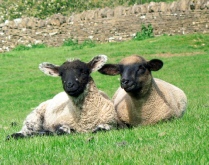


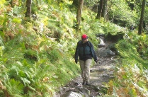


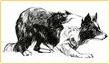
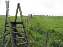
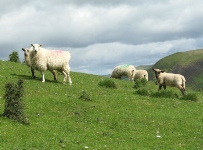
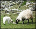
We enjoy long distance walking in Britain and Ireland for a host of reasons. More than anything, we relish the pastoral settings. With each stile we climb or gate we pass, thoughts turn to seeing a border collie running a pasture to gather its sheep. As we cross a field, lambs often unaware of our presence until we’re nearly upon them, bound away to their mothers’ protection.
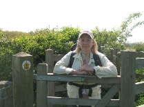
We view the trip as a walk and not a hike. Hikers carry heavy packs filled with camping gear. Walkers stay at B&B’s and travel light. We carry little more than waterproofs and emergency gear. Some walks have luggage transfer services that will drop off your bags at each night’s lodging, but with quick dry clothing allowing for an evening wash if needed, we find no need for additional outer wear.
Walks are typically 100+ miles, requiring a week or more to complete. However, with trains or buses servicing locations along the way, walkers often have an option to do just a portion of the route. For example, we walked Scotland’s West Highland Way in two trips, breaking at Tyndrum, which is serviced directly by train from Glasgow.
We enjoy walking 12 or so miles a day, which fits well with distances between villages. The terrain is rarely difficult with most walking on well worn trails and tracks. (More able walkers may well cover 18 miles a day without difficulty.) With a late setting spring and summer sun, even if we don’t start walking until noon there’s no hurry to make it to our next lodging before nightfall. With the exception of a couple segments on Ireland’s Dingle Way, road walking was on minor roads with little concern for vehicular traffic. To avoid muddied paths, we’ve even taken to tarmac on occasion.
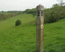
Paths are “way-
Following are long distance walks we’ve made in Britain and Ireland. Underlined titles are links to their web sites. Some walks are part of the Britain’s National Trails network. We’ve found all of the trail officers to be quite helpful in our enquiries.
The Internet and email make planning walks from overseas quite easy. You may also want to join the Long Distance Walkers Association, which has information on more localized and regional walks as well as a forum where you can post questions to other members. If you wish additional information on the walks we’ve completed, such as recommendations on lodging, please email us.
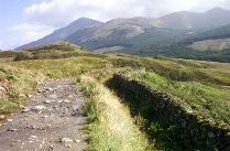
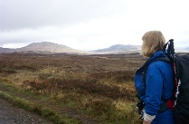
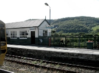
West Highland Way (Scotland) Trail symbol is Scotland’s national flower, the thistle. Starting in Milngavie (Mil-
Favorite section was Inveroran to Kingshouse in crossing the stark wild of Rannoch Moor.
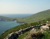
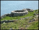
Dingle Way (Ireland) Trail symbol is a backpacker with walking stick. Starting and ending in Tralee, the trail travels 110 miles around the Dingle Peninsula in southwest Ireland. We started in Camp, a short bus ride from Tralee, and walked the southern side of the peninsula from Annascaul to Dingle town and out past Dunquin to Feohanagh. We were fortunate to have clear skies and no rain for the entire walk. The views out over the sea rank as some of the most spectacular scenery we’ve ever seen.
Favorite section was the western headlands beyond Ventry out to Dunquin with its sheep dotted stone fenced pastures and clochains. Time your arrival around Slea Head to stop at the Italian cafe for a tea and pastry break.
Costwold Way (England) Trail symbol is the acorn, the symbol used for all of Britain’s National Trails. The Cotswold Way winds for 100 miles along the Cotswold Escarpment between Chipping Campden and Bath. We broke our walk into two sections. We first walked the northernmost sections from Chipping Campden to Winchcombe. Then we caught a bus into Cheltenham and a train to Dursley, where we resumed the walk to Bath. As with our Ireland walk, we were fortunate not to have any rain the entire week.
In lieu of noting a favorite section, we highlight the many stone cottage villages with their welcoming tea rooms. Bath, at walk’s end, was an urban treat. We walked nearly as much in Bath as we did on the trail!
Glyndŵr's Way (Wales) Trail symbols are the acorn and Wale’s national symbol, the red dragon. A relatively new National Trail, established in 2000, we came across just two other walkers during our June 2011 Machynlleth to Welshpool walk. This segment represents the northern portion of the Llwybr Glyndŵr (recommend to review basic Welsh pronunciation ahead of time to more readily recognize place names). We detoured from the Glyndŵr's Way east of Pont Llogel to keep with the Ann Griffiths Walk along the River Vyrnwy, rejoining the path at Dolanog. This detour made for a nice respite from the prior days’ hill climbing. We had one day of heavy, continuous rain, but fortunately it was a short walking day so we were showered, dried and warmed by a fire at the Old School B&B (Welshpool) by mid afternoon.
We didn’t have an overwhelming favorite section, except that mile for mile, we thought it was the most picturesque of all our walks. Welshpool at walk’s end is quite pleasant with its shops and Powis Castle is just a short walk away.


| Goose Dogs at Work |
| Potpourri |
| More Placed Goose Dogs |
| Dog Vest Measuring Guide |
| Dog Vest Policies |